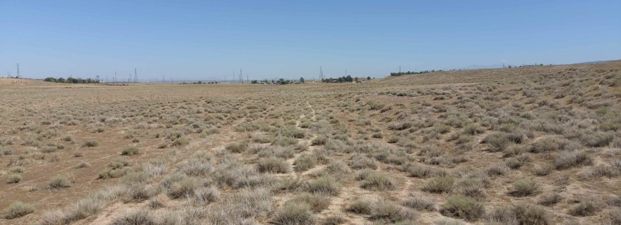
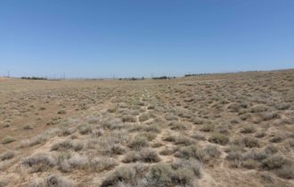
2.53 acres located in California poppy Reserve
APN# 3266-011-021
Payment Options
ATTRIBUTES:
* Located in the most beautiful area on Lancaster: Antelope Valley California Poppy Reserve.
* Very close to Art IN Residence
* Nearby Antelope Valley Sportsman Club
* Close to Elizabeth Lake
* Next to St Francis Rehabilitation Rescue Rockin Ranch.
* Zoned HEAVY AGRICULTURAL. Basically, this is like a R-1 zone, in that it allows one single-family residence (SFR) per lot. An SFR can be a mobile home, modular, manufactured home, or traditional build
* Physical and legal access confirmed by title company
* Two parcels available next to each other. So you can purchase 2 properties and build 2 houses next to each other. Perfect for siblings, family with children, etc.
ALL OUR PROPERTIES HAVE
* Clean title
* Current taxes
* FREE Title Report available
ATTRIBUTES:
*Buyer to make their own independent investigations regarding zoning & General Plan Designations, Hazard Zones, Availability & Costs of utilities.
Utilities:
1. For water, youd need a water company connection/meter, or drill a well for your SFR (trucked-in water is not allowed).
2. For electricity, please contact Southern California Edison (SCE) to see if electrical power would be available to the lot. In most cases, the County does not allow a SFR to be entirely off the grid from SCE. (i.e.: Even if you install wind or solar power, you still need an SCE connection).
Here are the phone numbers to call utility companies to find out the cost and process of bringing utilities to this lot, if available:
1. Southern California Edison (SCE) 661-726-5617
2. LA County Water Co. 661-940-9270
3. Sewer 626-300-3309
4. The Gas Company 877-238-0092
Los Angeles County, CA
APN: 3266-011-021
Property Address
VAC/AVE H8/VIC 134 STW
LANCASTER, CA 93536
TAX AMOUNT: $143.41/ CURRENT :_)
ACRES: 2.53 +/-
LAND SQUARE FOOTAGE: 110,154.00
Legal Description
LEGAL: TRACT NO 30587 LOT 53
COORDINATES:
34.7122521248454,-118.366676802754
34.7123570989374,-118.367166152046
34.7122543863726,-118.367220935172
34.7118707554718,-118.367425479073
34.7118148517231,-118.367451817136
34.7117572667269,-118.367472161204
34.7117023006697,-118.367485625057
34.7116466120921,-118.367493626848
34.7115905704797,-118.367496113499
34.7108495589113,-118.367492466697
34.7108674308073,-118.366860187095
34.7109502373078,-118.366845845502
34.7119833945078,-118.366666697777
34.7121304777906,-118.366641192944
34.7122404659803,-118.366622073643
Google Map Link:
https://goo.gl/maps/Za7PAFpDXxtgM4GV7
All information we have on this property is disclosed within the content of the listing page.
Any and all other information on this property should be directed toward the city or county of which the property is located in.
Your due diligence should be performed, to ensure the property meets your needs and criteria.
About the Seller:
We are a husband and wife who love to invest in land.
We review thousands of properties for everyone that we buy in order to bring you the BEST deal possible.
The pricing we get them at is reflected in the pricing of what I am selling them for. They are priced at half the current market price or less TO SELL.
Because of their price they don’t usually stay for sale for very long.
The buyer is responsible for learning all the restrictions from the county/ township/ planning and zoning office.
What you can or cannot legally do on the land is controlled by the local government, not by us or any seller.
Please contact the county, providing them with the parcel number, to confirm zoning, access, and available utilities.
Thank you for searching and taking interest in our land!
Patrycja & Tom with Land Addiction
If you have any questions, TEXT Patricia: 773-398-8027
Property Information
Parcel Size
2.53
State
California
County
Los Angeles
Nearest Cities
LANCASTER
Parcel Number
3266-011-021
Address
VAC/COR AVENUE H9/134 STW, LANCASTER, CA, 93536
Legal Description
TRACT NO 30587 LOT 53
Features
Acres
2.53
County
Los Angeles County
Access
Physical and legal access confirmed by title company.
Coordinates
34.7122521248454,-118.366676802754 34.7123570989374,-118.367166152046 34.7122543863726,-118.367220935172 34.7118707554718,-118.367425479073 34.7118148517231,-118.367451817136 34.7117572667269,-118.367472161204 34.7117023006697,-118.367485625057 34.7116466120921,-118.367493626848 34.7115905704797,-118.367496113499 34.7108495589113,-118.367492466697 34.7108674308073,-118.366860187095 34.7109502373078,-118.366845845502 34.7119833945078,-118.366666697777 34.7121304777906,-118.366641192944 34.7122404659803,-118.366622073643
Zoning
Heavy Agricultural
Elevation


